

Last updated October 28, 2026
This post contains Amazon affiliate links. As an Amazon Associate I earn from qualifying purchases, at no extra cost to you.
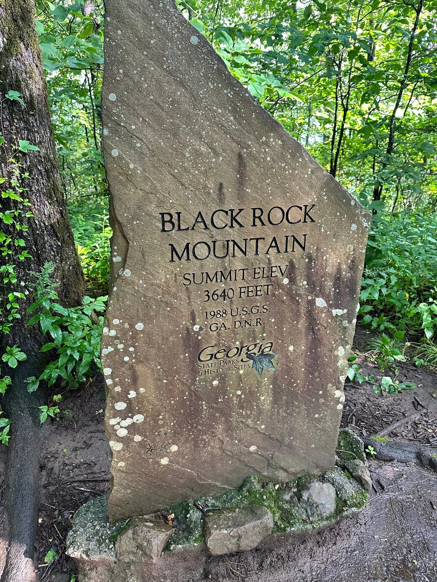
Most people drive right past Black Rock Mountain on the way to somewhere else. That's a mistake. At 3,640 feet, it's the highest state park in Georgia, it sits about 10 minutes north of downtown Clayton, and on a clear day the views stretch up to 80 miles from overlooks you can practically park at.
Being up that high, looking out over the valleys and everything around you, makes you realize just how small you are compared to the rest of the world. The greenery and just being out in nature does something to my soul. Places like this are how nature heals you.
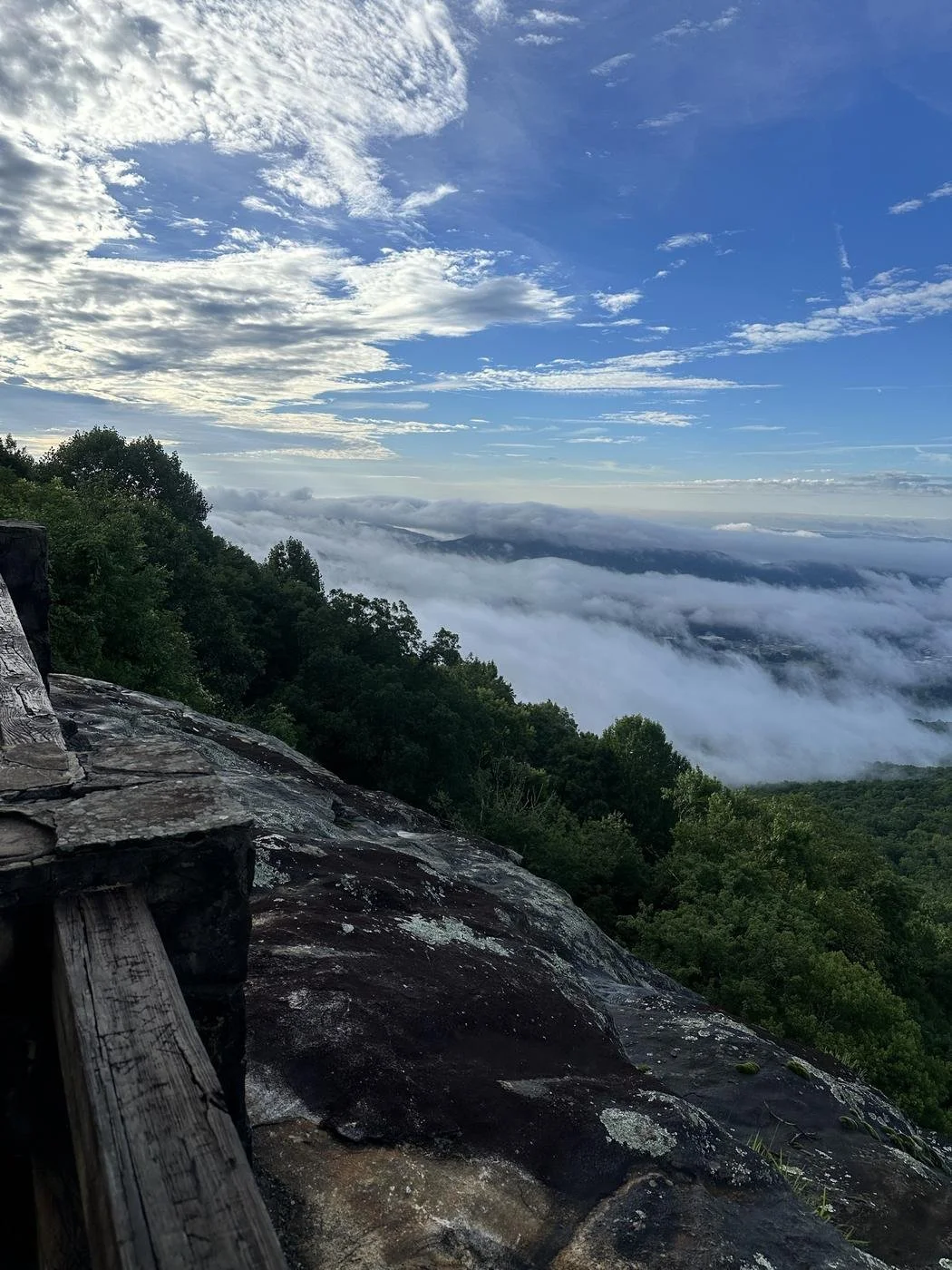
Get up there early if you can. On cool mornings the valley fills with clouds, and you end up standing above them while the sun comes up over the mountains.
This guide covers the trails worth your time, the overlooks for when nobody in your crew wants to hike, what it costs, how to time your visit for fall color (it shows up here before almost anywhere else in the state), and where to eat in Clayton after.
Free download: my North Georgia Waterfall Checklist. 14 falls ranked from 100-yard walks to all-day hikes, on one list you can check off on your phone. Get the free checklist
The Quick Basics
Where: 3085 Black Rock Mountain Parkway, Mountain City, GA, about 10 minutes north of Clayton
Drive time: About 2 hours from Atlanta
Cost: $10 per vehicle for a Georgia State Parks ParkPass
Hours: The park is open 7 AM to 10 PM. The office is open 8 AM to 5 PM.
Elevation: 3,640 feet, the highest state park in Georgia
Best for: Big views with almost no effort, a moderate summit loop, and the earliest fall color in the state
Where Is Black Rock Mountain State Park?
Black Rock Mountain sits in Rabun County, the far northeast corner of Georgia, right above the towns of Clayton and Mountain City. The park straddles the Eastern Continental Divide, which is a fancy way of saying rain that falls on one side ends up in the Atlantic and rain on the other side ends up in the Gulf.
The road up, Black Rock Mountain Parkway, is steep, narrow and winding, with no shoulder. Take it slow, especially if you're pulling a camper. At this elevation the park can close when the roads ice over in winter, so check before you drive up on a cold morning.
The Views You Can Drive To
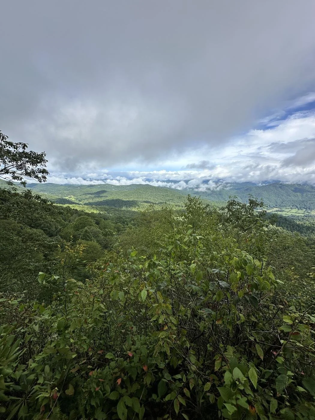
Here's the secret that makes Black Rock perfect for mixed crews: you don't have to hike to get the view. The road climbs nearly to the summit, and the overlook at the Summit Visitor Center looks out over rolling Blue Ridge Mountains for miles. There's a gift shop inside if anyone needs a souvenir.
If your group includes grandparents, little kids, or anyone who said "I'm not hiking," this is your move. Park, walk a few steps, and you get most of the drama for zero effort.
The Trails
Tennessee Rock Trail (the one to do)
This is the summit loop, and it's the reason to bring hiking shoes. It's a 2.2-mile loop, marked with yellow blazes, that climbs through high forest to a rock outcrop with views north into North Carolina, toward Albert Mountain and Pickens Nose. On a clear day, the park says you can see more than 80 miles.
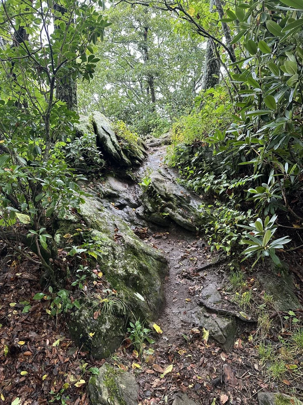
Hike it counterclockwise. That saves the main climb, and the big views, for the end. Along the western side you'll pass through an area still showing damage from an EF-2 tornado, which is a strange and humbling thing to walk through. Expect rocky, rooty sections that stay slick after rain.
It took me about an hour and 20 minutes, and that was with plenty of stops to enjoy the scenery and just stare out into the mountains.
Distance: 2.2-mile loop
Difficulty: Moderate, with a steep stretch
Time: About 1 hour 20 minutes with photo stops
Trailhead: Shares a lot with the James E. Edmonds Backcountry Trail
Black Rock Lake Trail
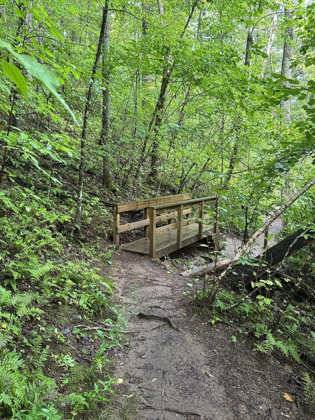
An easy 0.85-mile loop around the park's 17-acre lake, with wooden bridges over the creeks and a wheelchair-accessible fishing pier. It's the best pick for little kids or a slow morning walk.
Distance: 0.85-mile loop
Difficulty: Easy
Norma Campbell Cove Trail
The park's newest and shortest trail, a 0.1-mile loop into a wooded cove right on the Eastern Continental Divide, with rock outcrops, springs and ferns. Five minutes well spent if you're already at the top.
Ada-Hi Falls Trail
A short, steep trail down through a shady cove to a viewing platform at Ada-Hi Falls, a small high-elevation cascade. Heads up: as of fall 2026, Georgia State Parks lists this trail as closed for stair repairs, so check before you plan around it.
Distance: 0.25 miles one way
Difficulty: Moderate to difficult (steep stairs)
James E. Edmonds Backcountry Trail
The big one: a 7.2-mile loop past small waterfalls in laurel-filled coves and up Lookoff Mountain, with a view over the Wolffork Valley. It's rated difficult to strenuous, so this is a full-day plan, not an add-on. Backcountry camping along it is by permit only at four sites, reserved in advance at 1-800-864-7275.
Distance: 7.2-mile loop
Difficulty: Difficult to strenuous
When to Go
Fall: Color starts at the top of Georgia and works its way down, and Black Rock is one of the first places to turn. Up here it usually begins in early to mid October and holds through late October on the lower slopes. October weekends get busy, so arrive before 9 AM or come for the last few hours of daylight.
Early mornings: Your best shot at clouds sitting in the valley below you.
Spring: Wildflowers in the coves, and later in the season rhododendron and mountain laurel along the trails.
Summer: Noticeably cooler than Atlanta, which makes it one of the better summer hikes in the state.
Winter: The clearest long-range views of the year, but the park can close in icy weather. Check before you go.
Where to Stay
If one day isn't enough, the park has 10 cottages, 44 tent, trailer and RV campsites, 12 walk-in campsites, 4 backcountry sites on the Edmonds Trail, and a pioneer campground. Bear boxes are provided at the walk-in and backcountry sites. Cottages go fast for October weekends, so book early. Overnight guests only pay the $10 ParkPass once per vehicle for the whole stay.
Prefer a room off the mountain? I stayed at The Cascades Inn in Tiger, just south of Clayton, a family-owned inn with a waterfall on the property.
What to Bring
The overlooks need nothing but a jacket. If you're doing the Tennessee Rock loop, here's what makes it easier:
Hiking shoes with grip: The rocky sections stay wet and slick, especially after rain.
A packable jacket: It's noticeably cooler at 3,640 feet, and windy at the overlooks.
Trekking poles: For the steep stretch and the rocky descents.
An insulated water bottle: There's no water on the trail.
These are Amazon affiliate links. If you buy through them, I earn a small commission at no extra cost to you.
Know Before You Go
Parking: $10 per vehicle for the ParkPass. Overnight guests pay once per stay.
Hours: Park open 7 AM to 10 PM, office 8 AM to 5 PM. Call the Visitor Center at 706-746-2141 with questions.
The road: Steep, narrow and winding with no shoulder. Take it slow.
Winter: The park can close when the roads ice over.
Ada-Hi Falls: Closed for stair repairs as of fall 2026. Check before you go.
Cell service: Spotty on the trails. Download your map before you leave Clayton.
Make It a Full Day: Pair It With Clayton
Black Rock is 10 minutes from downtown Clayton, and the two were made for each other. Hike in the morning while it's cool, then head down the mountain to eat. I lay out a whole day in town, hour by hour, in The Perfect Saturday in Clayton, GA.
My two stops after the mountain: South Main Market for sandwiches, then Bean & Basil for fresh, small-batch ice cream. Grab a seat on the patio and you've earned it.
For more mountain days in this corner of the state, see Tallulah Gorge State Park, about 20 minutes south, and my Best Fall Foliage Hikes in North Georgia.
Want the whole weekend planned? Clayton is one of five trips in North Georgia Weekends ($79): a Saturday planned hour by hour, plus Friday night and Sunday, three places to stay and a rain plan for every stop. Just want one great day? Start with 5 Perfect North Georgia Saturdays ($9.99).

Black Rock Mountain FAQ
Can you drive to the top of Black Rock Mountain? Yes. The road goes nearly to the summit, and the Summit Visitor Center overlook is a short walk from the parking lot.
How long is the Tennessee Rock Trail? It's a 2.2-mile loop, rated moderate, and it took me about an hour and 20 minutes with stops. Hike it counterclockwise to save the climb and the best views for the end.
How much does it cost to visit Black Rock Mountain State Park? $10 per vehicle for a Georgia State Parks ParkPass. An annual pass covers every Georgia state park.
When is fall color at Black Rock Mountain? Usually early to mid October at the top, holding into late October lower down. It's one of the first places in Georgia to turn.
How far is Black Rock Mountain from Atlanta? About 2 hours, and about 10 minutes north of downtown Clayton.
More in North Georgia, or find a trip by drive time. Want company on the trail? The Explore Georgia Hiking Club is free, and every pace is welcome.