

Last updated October 28, 2026
Almost every waterfall trip I take heads north. So for this one I went the other way. High Falls State Park sits near Jackson in Middle Georgia, about an hour south of Atlanta, and it's home to what the park calls the tallest cascading waterfall south of Atlanta: a wide cascade on the Towaliga River that's only minutes from the parking lot.
The trails are well maintained, the views and the sound of the water are amazing, and the park has a lot more going on than the falls: a 650-acre lake, mill ruins, camping and yurts. This guide covers which trail to take, what it costs, the history behind the ruins and the mistakes to avoid.
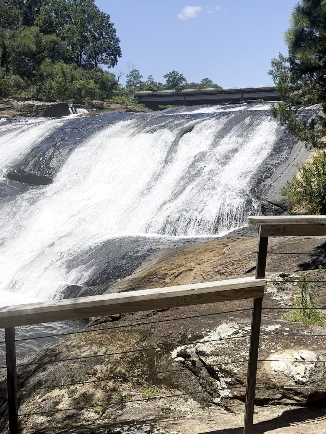
The view from the overlook, a short walk from the parking lot.
High Falls State Park at a Glance
Where: 76 High Falls Park Drive, Jackson, GA 30233, just off I-75 at Exit 198
Drive time: About an hour south of Atlanta, in Middle Georgia northwest of Macon
Hours: 7 a.m. to 10 p.m. The park office is open 8 a.m. to 5 p.m.
Parking: $10 per car per day, or $70 for an annual Georgia State Parks ParkPass that covers every state park
The falls: A 135-foot cascade on the Towaliga River, the tallest cascading waterfall south of Atlanta
Size: 1,050 acres, including the 650-acre High Falls Lake
Trails: Three trails, from a 0.5-mile easy history walk to a 2.5-mile woodland loop. You can do all three in one visit.
Water rules: No swimming or wading in the lake or river
Camping: 106 campsites, 6 yurts, a pioneer campground and a paddle-in primitive site
Phone: 478-993-3053
The Waterfall: The Tallest Cascade South of Atlanta
High Falls isn't a single drop. The Towaliga River spreads out across wide granite ledges and tumbles down in a series of white cascades, about 135 feet in all from top to bottom. The park calls it the tallest cascading waterfall south of Atlanta, and the views and the sound of the water are amazing.
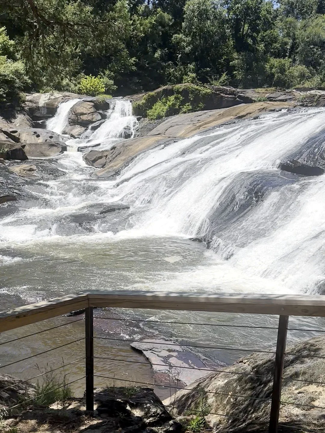
The cascades spread across wide granite ledges.
It's also easy to reach. The falls are only minutes from the parking lot, so you don't need a big hike to see them. That makes this a great pick for kids, for a short stop on a drive down I-75, or for anyone who wants a waterfall without an all-day trek.
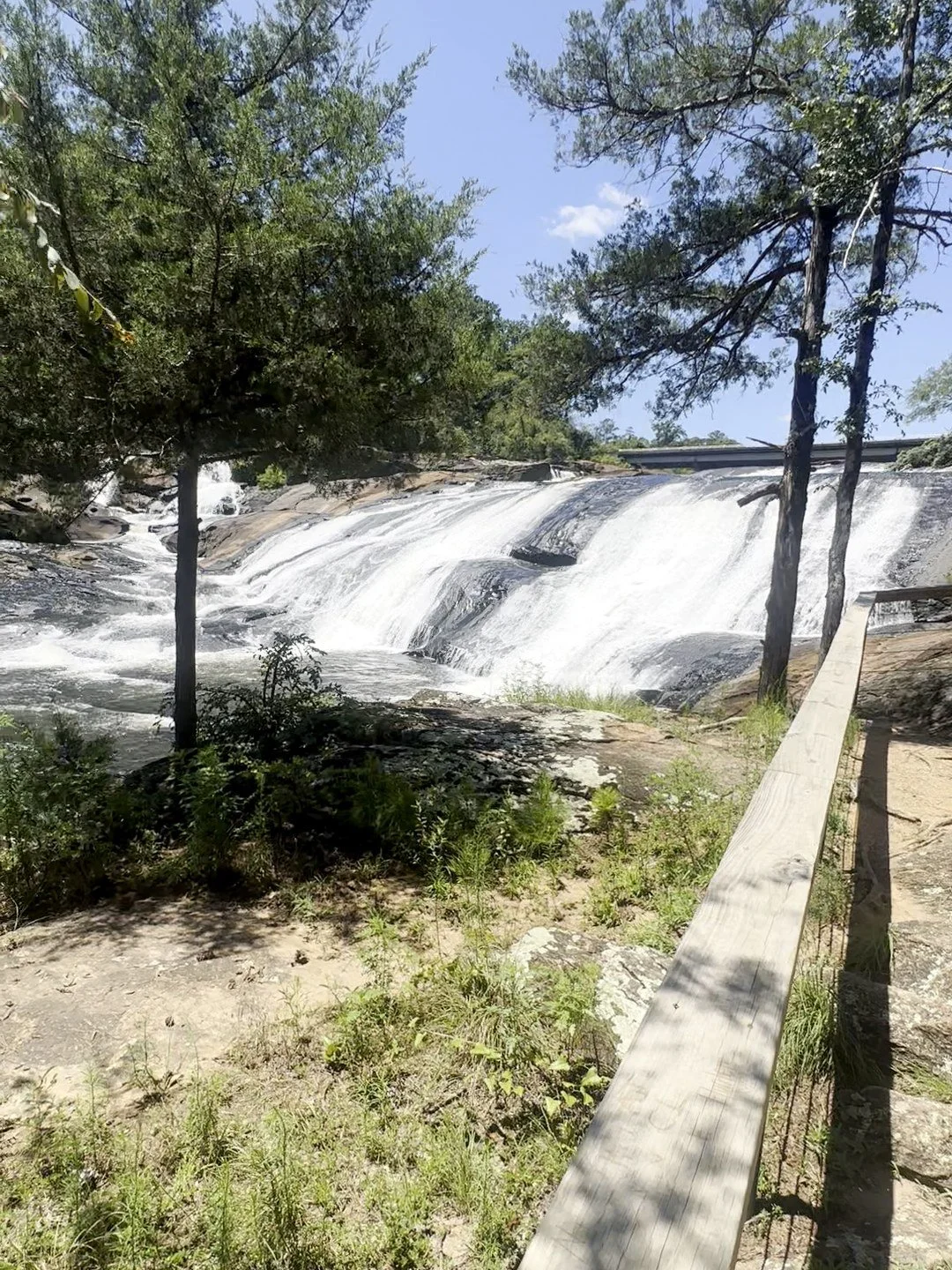
Another angle on the falls through the pines.
The Trails at High Falls
Here's the full lineup from the park's trail list.
Falls View Trail: 1.5 miles, rated strenuous, natural surface. A double loop through rocky forest along the river below the falls. The trailhead is across the street from the day-use area.
Historic Trail: 0.5 miles, easy, crushed gravel and ADA accessible. Passes the dam, old berm walls, the powerhouse penstocks, the grist mill site and the Old Alabama Bridge, with an overlook of the falls partway down.
Tranquility Trail: 2.5 miles, moderate, natural surface. The park's longest trail, a hilly walk through the woods with a stream running through parts of it.
I've done every trail here. The park isn't that big when it comes to trails, so you can easily cover all three in one visit, and they're all well maintained. My favorite is the waterfall trail. You get amazing views of the falls with just a short walk across from the parking lot, and it doesn't involve any real hiking at all.
One heads-up: I was told the park has a lot of snakes. I didn't see any, but watch where you step, especially on the rocky stretches.
Falls View Trail
This is the waterfall trail, and it's my favorite in the park. The best part comes right at the start: walk across the street from the parking lot and you're at the views beside the cascades in a few minutes, with no real hiking. If you keep going, the full trail is a 1.5-mile double loop through the woods along the river below the falls. The park rates that part strenuous because it's rocky, with boulders scattered all over the forest floor, so wear shoes with real grip.
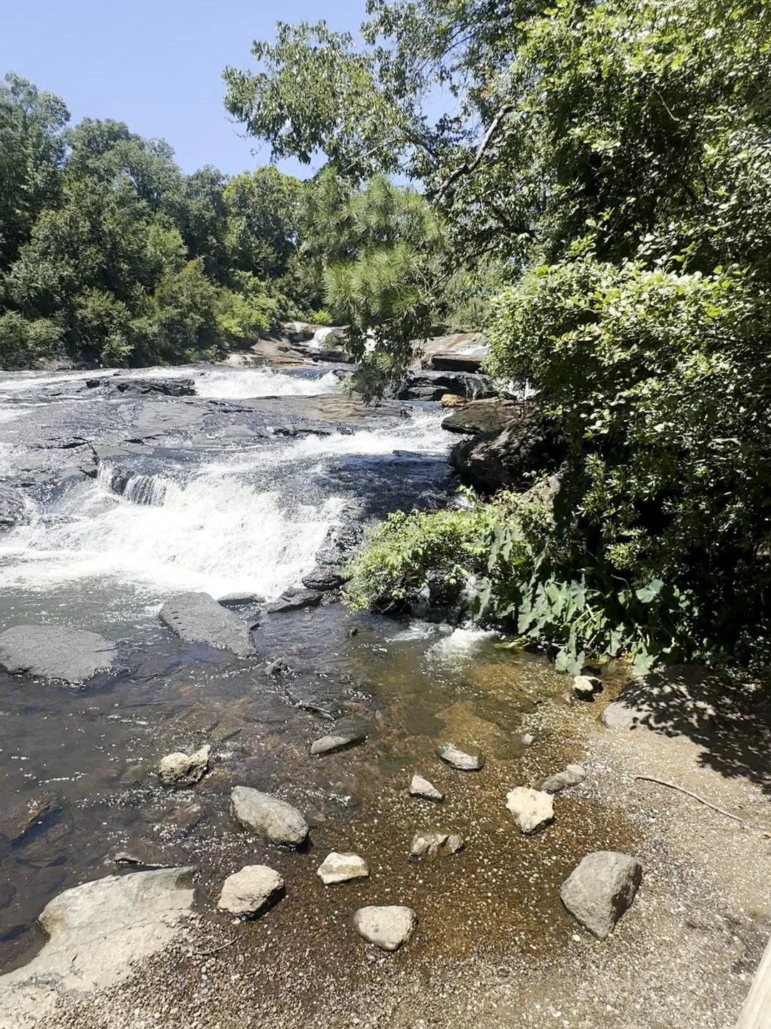
The Towaliga River below the falls.
Below the falls, the Towaliga spreads out over wide shoals and rocks. It's pretty, and it's tempting to climb around on, but the park's rules are clear: stay off the rocks and out of the water. The park warns that serious injuries can happen on the rocks and in the water.
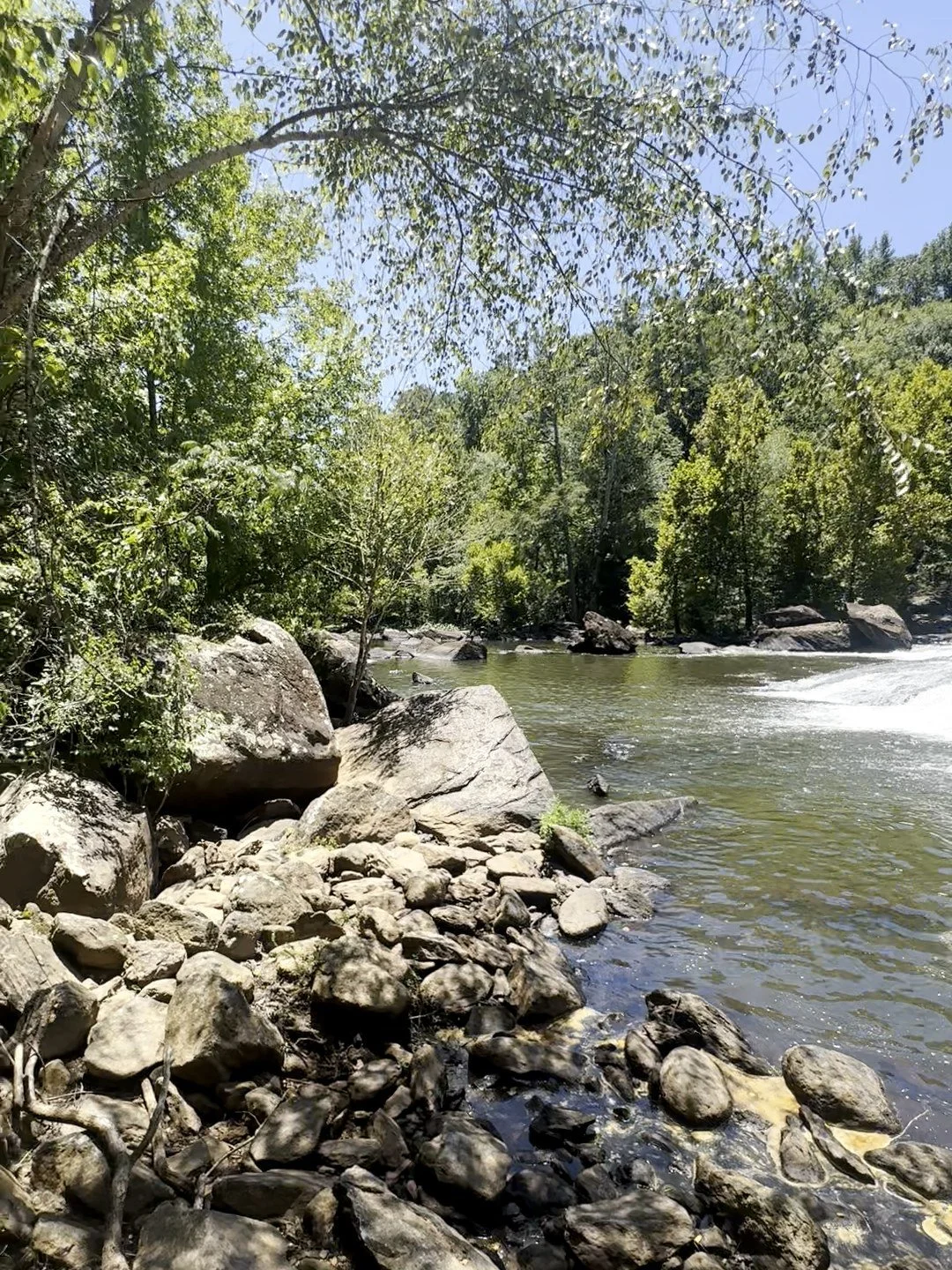
Rocks along the river. The park asks everyone to stay off them and out of the water.
Historic Trail
If you have kids, a stroller or limited time, start here. The Historic Trail is a flat half-mile on crushed gravel that walks you past what's left of the old town's industry: the dam, the berm walls, the powerhouse penstocks, the grist mill site and the Old Alabama Bridge. There's an overlook of the falls partway down, so you still get the view.
High Falls Lake and the Dam
Above the falls, the river backs up behind a dam into High Falls Lake, a 650-acre lake with two boat ramps, fishing docks and boat and paddling rentals. The lake is known for hybrid and white bass. Water spills over the long, curved dam in a white sheet, which makes a second waterfall view right by the day-use area. Stay off the dam itself.
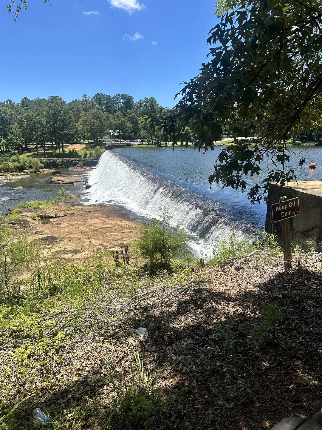
High Falls Lake spilling over the dam.
Heads-up for this winter: the park says High Falls Lake will be lowered from November 1, 2026 to January 31, 2027. If you're planning to fish or paddle in that window, call the park first at 478-993-3053.
For one more great view, walk out onto the bridge over the Towaliga River. Looking upstream, you can see the river spread across the rocks with the dam in the distance.
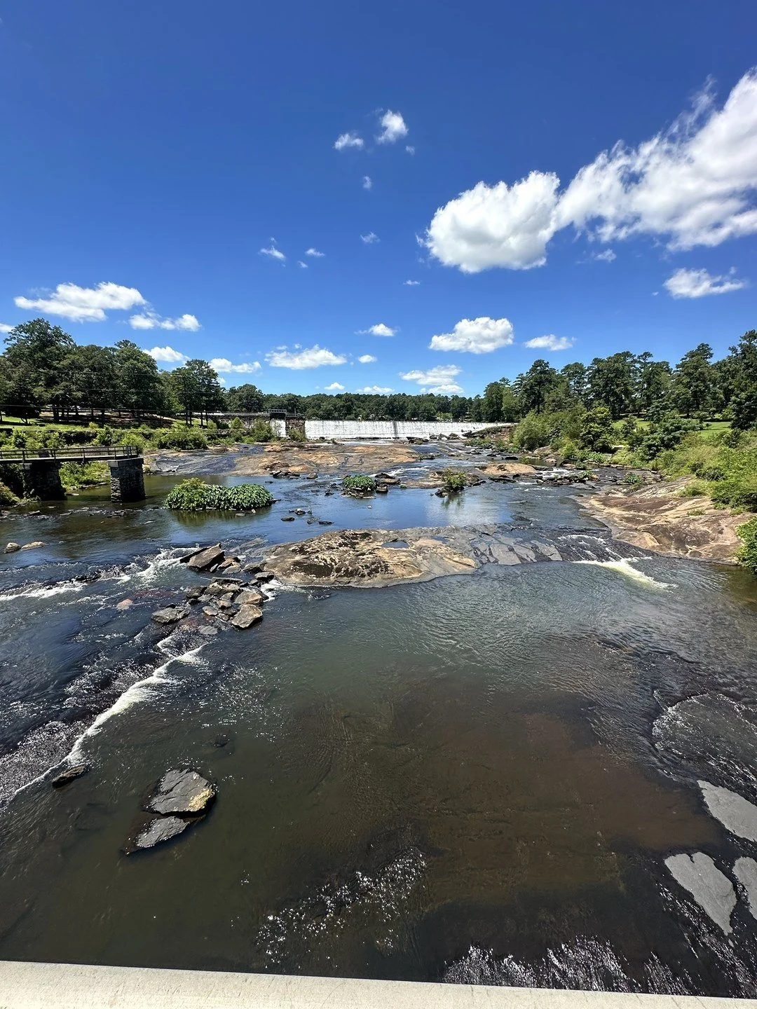
Looking upstream toward the dam from the bridge.
The History Behind the Ruins
High Falls was once a real town. In the early 1800s it was a busy industrial stop with several stores, a grist mill, a cotton gin, a blacksmith shop, a shoe factory and a hotel, all powered by the river. When a major railroad bypassed the town in the 1880s, it faded and eventually became a ghost town.
Later, the river was put to work making electricity, and you can still see the powerhouse penstocks and the foundation of the old hydroelectric plant. The bridge on Old Alabama Road was built in 1890 and was mostly destroyed in the flood of 1994. The Historic Trail is the easiest way to see what's left.
Camping, Yurts and Other Things to Do
Campsites: 106 tent, trailer and RV sites with electric hookups, some of them seasonal
Yurts: 6 canvas-and-wood yurts with a deck, grill, heat, air-conditioning and a ceiling fan
Paddle-in camping: One primitive site you reach by boat, plus a pioneer campground for groups
Picnicking: 5 picnic shelters, a group shelter and 2 playgrounds
Boating and fishing: 2 boat ramps, fishing docks, and boat and paddling rentals
Geocaching: The park has caches if you want something for the kids
I'm planning to come back and camp here in the fall once it cools down. Reserve campsites and yurts through Georgia State Parks at 800-864-7275 or online.
Where to Eat Nearby
For dinner after the falls, head into Jackson for Mesquite Mexican Grill & Bar at 34 3rd St. It's a Mexican restaurant, and it's really good. It's also a great pick for a group: they can fit a party of 10 with ease, which makes it an easy stop after a hike with friends or the family.
When to Visit High Falls
The falls run all year, and they're usually strongest after a good stretch of rain. I visited on a sunny afternoon in late July. If you go in summer, plan for heat on the open rock near the falls and go earlier in the day. Fall brings cooler temperatures for the rocky Falls View Trail and is the best time to camp.
Keep the lake drawdown in mind if you visit between November 1, 2026 and January 31, 2027.
Mistakes to Avoid
Climbing on the rocks or getting in the water. Swimming and wading aren't allowed in the lake or river, and the park asks everyone to stay off the rocks.
Walking on the dam. It's posted. Enjoy the view from the bank.
Underestimating the Falls View Trail. It's short but rated strenuous. Wear shoes with grip, not sandals.
Forgetting about snakes. Stay on the trail and watch where you put your hands and feet.
Skipping the parking fee. Every car needs a $10 ParkPass, even if you're only stopping to see the falls.
Showing up to fish or paddle during the drawdown. Call ahead between November 1, 2026 and January 31, 2027.
How to Get to High Falls State Park
High Falls is in Jackson, about an hour south of Atlanta, right off I-75. Take Exit 198 for High Falls Road and follow it about 1.7 miles to the park entrance, right after the bridge over the Towaliga River. Put "High Falls State Park" into your map, or use 76 High Falls Park Drive, Jackson, GA 30233.
Frequently Asked Questions
How tall is the waterfall at High Falls State Park?
The cascades drop about 135 feet in all. The park calls it the tallest cascading waterfall south of Atlanta.
How far is the waterfall from the parking lot?
Just minutes. The Falls View Trail starts across the street from the day-use area, and the Historic Trail has an overlook of the falls along an easy half-mile walk.
Can you swim at High Falls State Park?
No. The park doesn't allow swimming or wading in the lake or the river, and it asks visitors to stay off the rocks.
How much does it cost to visit High Falls State Park?
Parking is $10 per car per day. An annual Georgia State Parks ParkPass is $70 and works at every state park.
What is the best trail at High Falls State Park?
The Falls View Trail, the waterfall trail. It's my favorite because the best views of the falls are a short walk across from the parking lot. The full 1.5-mile loop past that is rocky and rated strenuous. For something flat and easy, take the 0.5-mile Historic Trail, which also has an overlook of the falls.
Can you camp at High Falls State Park?
Yes. The park has 106 campsites, 6 yurts, a pioneer campground and a paddle-in primitive site. Book through Georgia State Parks.
How far is High Falls State Park from Atlanta?
About an hour south of Atlanta, right off I-75 at Exit 198 near Jackson.
Make It a Full Day
High Falls pairs well with other easy state park trips around Atlanta. For rapids and mill ruins on the west side, read my Sweetwater Creek State Park guide, and for a granite dome with a guided summit hike, see my Panola Mountain State Park guide. For more parks, start with my Georgia State Parks guide, or use Find a Trip to plan your next one. Make it a two-park day with Indian Springs State Park, Georgia's oldest state park, just south of Jackson. More in Middle Georgia.
Want to hike with a group? The Explore Georgia Hiking Club runs free group hikes around Georgia, and every pace is welcome.